Cross-Country to La Crosse
August 2015: After two and a half years of sporadic effort, I finally got around to taking (and passing!) the VFR private pilot oral/practical exam. As part of my preparation, I flew a cross-country solo trip to La Crosse, Wisconsin.
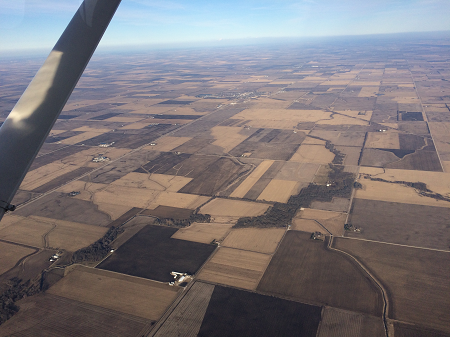
Wisconsin terrain is not like Illinois terrain. Here is Illinois:
Here is Wisconsin:

In contrast to Illinois, if your GPS goes out in Wisconsin, and you haven’t been paying attention to your course heading and location, and your VOR navigation skills are rusty, then you could be in trouble!
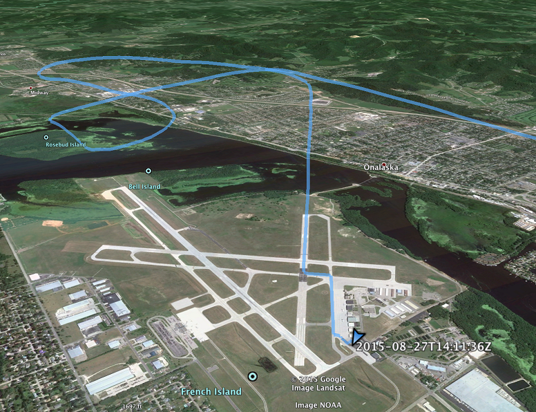
I made it to La Crosse fine. But then, to expand on the theme of not paying attention…Here’s what a GPS course track looks like (for a hypothetical pilot, of course) cleared for runway 22 at La Crosse, who accidentally lines up a final approach for runway 18, and eventually gets sorted out and lands on 22:
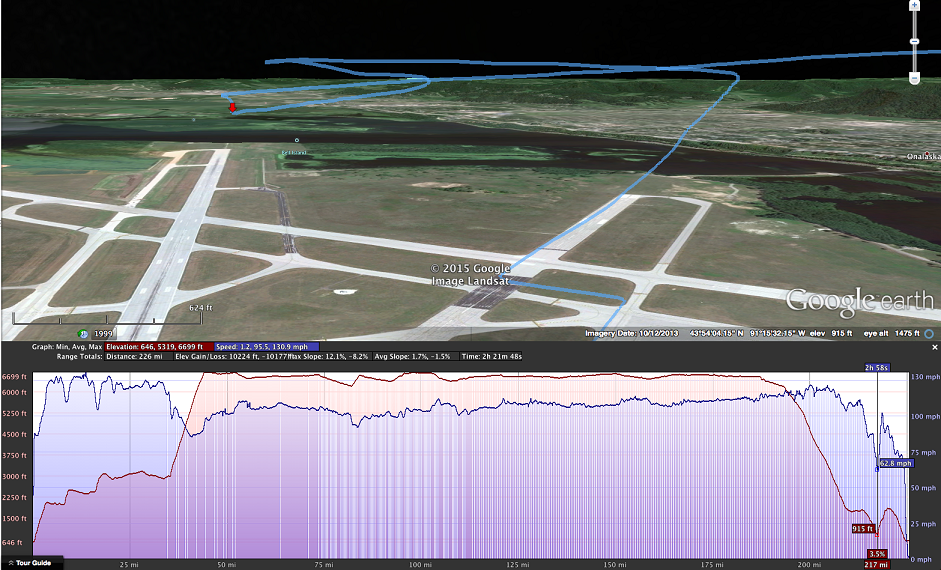
Here’s another, elevation-oriented view. Our hypothetical pilot had a decently stabilized approach for 18 (although he slightly overshot the turn to final). At the red arrow, ground speed is 63 mph, which works out to about 65 knots given a slight headwind. Altitude is 915 ft mean sea level (MSL), or about 270 ft above ground level (AGL). It would’ve been a smooth landing, with the minor drawback of not being cleared for it.
The controllers at KLSE are very laid-back. “La Crosse Tower, Cessna Niner-Six-Niner Romeo Romeo lined up the wrong runway, making a left turn”. “Niner Romeo Romeo, we saw you coming. You can have one-eight if you like.” “La Crosse Tower, Niner Romeo Romeo. Two-two is fine, thanks, I need the practice.” “Niner Romeo Romeo, runway 22, cleared to land!”